


Document Actions
gvSIG-Desktop 1.12. User manual
gvSIG 1.11 User manual - Viewing and accessing data - Load data - Geographical data - Vector - geoDB Extension (database manager) - Exporting a gvsig layer to a spatial database
This function allows new tables to be created in the spatial database from any vectorial source in gvSIG. These tables can be created as follows:
- Create a vectorial layer of any type, for instance by opening an SHP file using the Add layer button (figure 9).
- Select the layer by clicking on its name in the left-hand side of the screen (figure 10).
- In the Layer – Export to menu, select the type of database you wish to export the layer to. The example shows an Oracle database (figure 11).
- You will then be asked to introduce the name of the table which will be created in the database (Oracle) and whether or not you wish to include the newly-created layer in the current view.
If all goes well, the new vectorial geoDB layer will appear in the view and you will be able to work with it in the usual way.
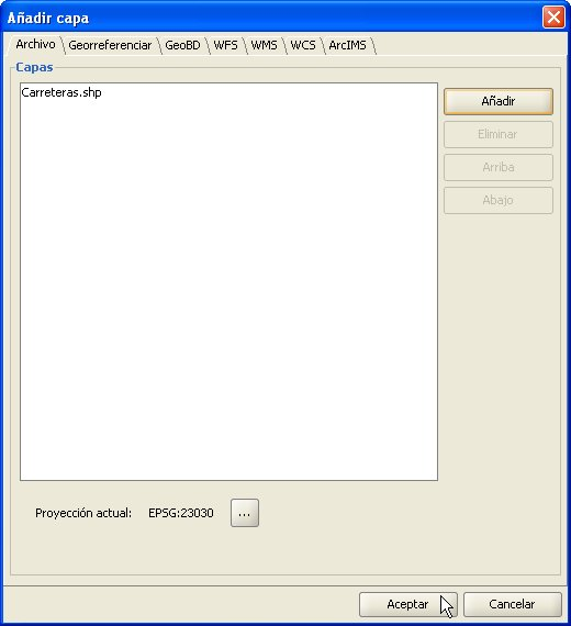
Figure 9. Adding a vectorial layer

Figure 10. Selecting the layer to export
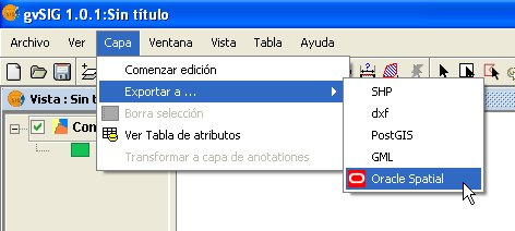
Figure 11. Exporting to Oracle Spatial
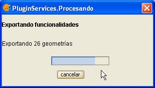
Figure 12. Export progress bar
Cached time 11/21/13 14:55:11 


